the highest quality seamless elevation data for Texas
Summit Geospatial offers the highest quality seamless terrain data in Texas, aggregated from the most recent DEMs of the state. Our data is continuously updated and expertly validated.
Try now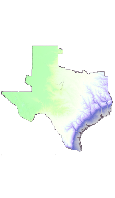
Summit Geospatial offers the highest quality seamless terrain data in Texas, aggregated from the most recent DEMs of the state. Our data is continuously updated and expertly validated.
Try now
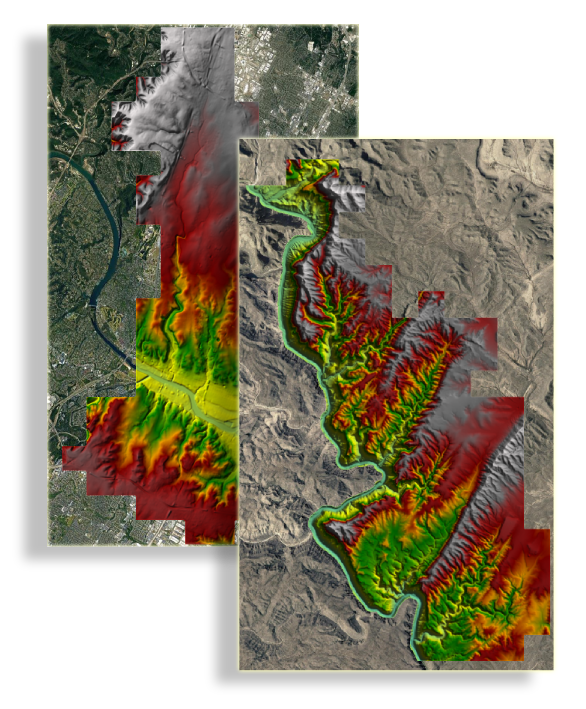
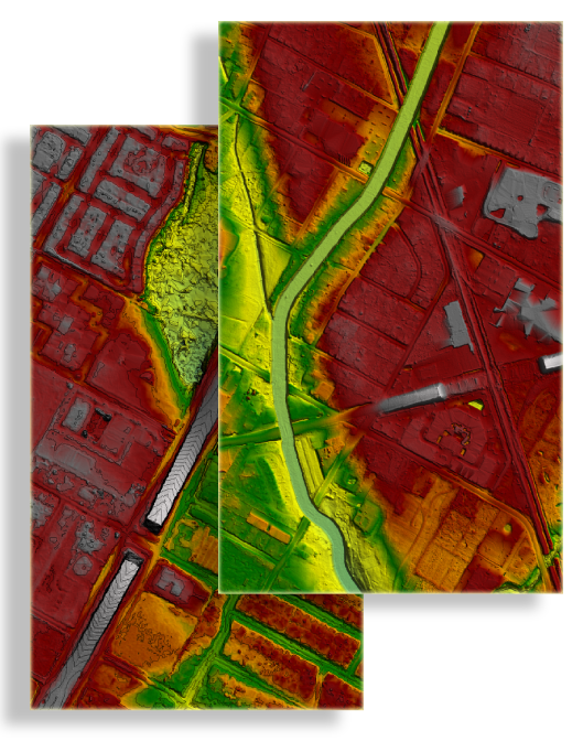
Our 1.2m high-resolution geospatial dataset is more than just images; it's a comprehensive source of insights ready to be tapped. From civil engineering, water resource management, to research and development, the possibilities are endless. Leverage our data to make informed decisions, fuel innovation, and elevate your operations to new heights.
Individual tiles or mosaics available! Select images available for free for you to try out.
Use our user-friendly web portal to select the geographic tiles you need for your project. Simply navigate the map and click on the tiles you wish to use.
After selecting your tiles, save them to your personal account or to your organization. This allows you to conveniently manage and retrieve your selections at any time.
When you're ready, download your selected tiles directly from your account. The tiles are conveniently packed in a widely compatible format, ready for you to use in your projects.
Make the most of the Summit Geospatial platform. With our extensive and constantly updated data collection, you're equipped with the most accurate geographic information for your needs.
Considering a big project? We offer special pricing for bulk purchases to help you own the vast geospatial landscape you need. Inquire about our exclusive deals and package prices.
Desire a hands-on approach? Summit Geospatial offers comprehensive licenses for our state-of-the-art software and extensive databases. Tailor your own geospatial solutions and shape your future with us.
Are you a university or a government organization? We have special discounts for those serving the public interest. Explore how our data can empower your public service initiatives.